Languages
Lubusz Nordic Walking Trails – Sulęcińska Szwajcaria – Lubniewice and the surroundings
Route 1: Baba Yaga
Large loop: Lubniewice – Jarnatów – Miechów – "Uroczysko" glade – Sobieraj – Lubniewice – 20 km
Small loop: Lubniewice – Jarnatów – Sobieraj – Lubniewice – 11.4 km
Trail color – green
Route type – historical and natural
Difficulty level – difficult route
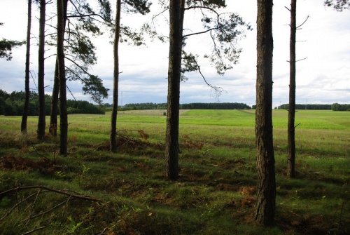
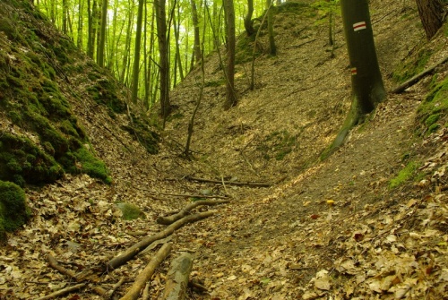
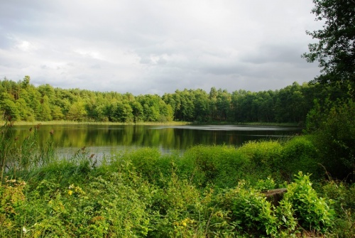
A very picturesque trail leading through the most attractive parts of the Lubniewicko-Sulęcińskie Lake District in terms of culture and nature. At first the trail leads along the shores of Lubiąż Lake along the so-called didactic path, then it turns west towards Jarnatów. Here the trail is divided into two parts: shorter – to Sobieraj, and longer – through Miechów, Żubrów, "Uroczysko Lubniewsko" to Sobieraj village, where the large loop joins the small one. Further on, the trail leads along the Sobierajski Canyon and then along the shores of Lubniewsko Lake.
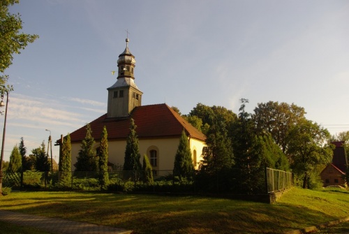
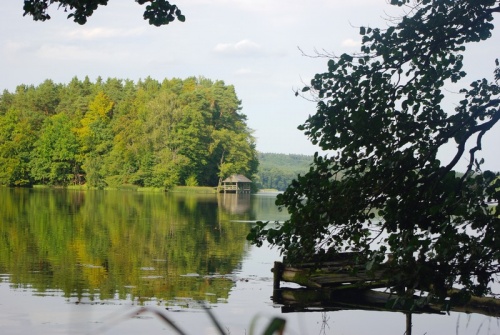
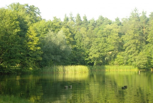
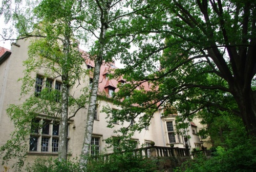
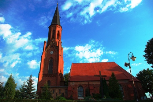
Attractions on the trail: historic oak avenue, manor layout with an 18th-century palace and park, historic tomb of the von Waldow family in Jarnatów, historic octagonal church in Żubrów, the "Uroczysko Lubniewsko" Nature and Landscape Complex, Lubiąż Lake, Lubniewsko Lake, historic maple avenue in Sobieraj.
A very picturesque route leading through the most attractive parts of the Lubniewice-Sulęcin Lake District in terms of culture and nature. The trail starts in Lubniewice at the tourist trail loop (yellow hiking-E11, red hiking, blue hiking) next to the viaduct of defunct railway, at the northern end of Lubniewsko Lake. At first the trail leads along the red hiking trail and the so-called didactic path prepared by the Lubniewice Forest District, then it turns west towards Jarnatów. You reach the historic oak tree alley, where the trail joins the red cycling trail. Pass the historic manor farm with its 18th-century palace and park, then pass the church and head towards the junction of the red and blue cycling routes. You reach the cemetery, where you will find a historic tomb of the von Waldow family. (In this place we can shorten the route by taking the little paved road to Sobieraj – here small loop and big loop are connected).
Next to the cemetery you turn west and get to the village of Miechów, where you can see a historic church. Further on, turn east and then south to reach Żubrów. In Żubrów head north-east and get to a clearing with a number of recreational shelters and places to make bonfires – you can rest here after a long march. From the clearing turn north and follow the green bicycle trail. On the right we pass an observation tower with a panorama of Lubniewsko Lake. Heading north, reach the Sobieraj village (the small loop joins the big loop here), then turning east and walking along the historic maple alley, you reach the Sobierajski Canyon. Go down the canyon along a rather steep slope towards Lubniewsko Lake. At the lake shore, turn north and then follow the blue hiking trail back to Lubniewice to the tourist trail loop (the place where our trail starts).
Route 2: Czart
Large loop: Glisno-Stary Nasyp-Wędrzyn-Dolina Czerwonego Potoku-Glisno-14.6 km
Small loop: Glisno-Stary Nasyp-Glisno – 5.4 km
Trail color – red
Route type – natural
Difficulty level – easy route
The trail starts in Glisno by provincial road 136. At first it runs along the old railroad embankment, crosses the Stawka Valley, and then the Potok Pod Grodziskiem ravine. The trail leads to the junction with the yellow cycling trail and the black cycling trail. (At this point you can shorten the route by going north-west along the black cycling trail. At the junction with the yellow hiking trail you will reach the big loop). The trail continues along Postomsko Lake to Wędrzyn. From Wędrzyn, the trail leads through a very diversified landscape of postglacial hills along the Red Stream Valley, and then along the Old Gliśno Road to Glisno.
Attractions on the route: "Uroczysko Lubniewsko" Nature and Landscape Complex, Postomsko Lake, Lubniewsko Lake, Wędrzyn Hills, Red Stream Valley, the old railway embankment
A typical off-road route. It starts in Glisno at provincial road 136 . At first it runs along a housing estate road next to a yellow hiking trail. It reaches the old railway embankment, crosses the Stawka Valley, and then the Potok Pod Grodziskiem ravine. The trail leads to a junction with the yellow hiking trail and the black cycling trail. (At this point you can shorten the route by going north-west along the black cycling trail. At the junction with the yellow hiking trail you will reach the big loop). The trail leads further along the yellow cycling trail and the black cycling trail, and then turns south along the yellow hiking trail, and runs by Postomsko Lake to Wędrzyn. From Wędrzyn, the trail leads west, and then north, through a very diversified landscape of postglacial hills, along the Red Stream Valley (parallel to the red hiking trail and the red cycling trail). Further on, the trail follows the blue cycling trail, and then the yellow hiking trail, until it reaches a viaduct across the tracks of a disused railway line.
Route no. 3 – Diablica
Large loop: Lubniewice (Market Square) – Krajnik Lake – Suszyce Estate – Leśniczówka – Śmierdzące Lake – Master Recreation Centre – Lubniewice (Market Square) – 9 km
Small loop: Lubniewice (Market Square) – Krajnik Lake – Suszyce-Lubniewice Estate (Market Square) – 5 km
Trail color – yellow
Route type – natural
Difficulty level – easy route
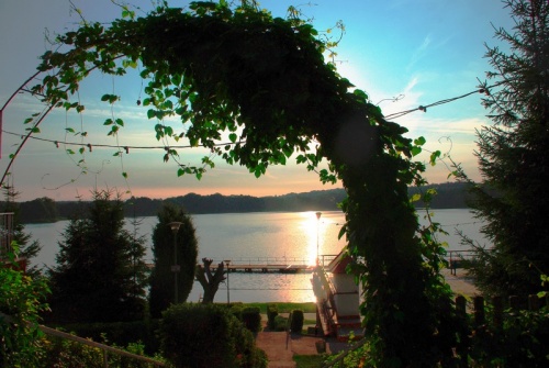
The trail leads from the Lubniewice Market Square around Krajnik Lake. In the Suszyce estate, the trail crosses the asphalt road to Osiecko. Here the trail leads in two variants: shorter– along an asphalt road west to the centre of Lubniewice, and longer – through Śmierdzące Lake to Lubniewice. The longer loop leads further on among numerous pools and interesting plant communities. When you reach the forest, the trail goes along a picturesque ravine with a small stream flowing in its valley. After passing "Śmierdzące" Lake, the trail leads to Lubniewice. Further on, the trail leads along a wooden footbridge located between two castles, and then along a promenade along Lubiąż Lake, which reaches the Market Square.
Attractions on the trail: historic church in Lubniewice, Krajnik Lake, Lubniewka River, Lubiąż Lake, the New Castle and the Old Castle in Lubniewice
We start the route at the Lubniewice Market Square, from which we go south-east towards Krajnik Lake and head south along the lake – (Ogrodowa Street, Strzelecka Street). Then we turn east towards Kasztanowa Beach and next towards Suszyce estate, passing on the way an inlet to the ravine (to be seen erratic boulder in the depth of ravine). The trail continues along the asphalt road to Suszyce. (Here the trail goes in two variants: a shorter asphalt road west to the centre of Lubniewice and a longer one through Śmierdzące Lake to Lubniewice, where the large loop connects with the small one). Head east along the asphalt road (direction to Osiecko), turn left and continue over a hill with a picturesque view of the city panorama. When you reach the forest go down along a ravine in the valley of which a small stream flows. Further on go along the ponds fed by the stream. Go across the bridge over the Lubniewka River, pass the forester’s lodge, turn sharply west and walk next to pools. Here you can observe the result of beavers activity – beaver lodges. Further on, pass interesting alder stands. Turn south and head towards Śmierdzące Lake. Walk along the lake from the north-east and then head south-east. We leave the forest path next to the MASTER Recreation Centre. Head towards Zamkowa Street, enter the park surrounding the New Castle. Cross the wooden bridge between the two castles, then take the promenade along Lubiąż Lake and exit at the Market Square.
Elaborated by: Edyta Suszek-Kluszczyk
Gallery:
Localization:
The public task is co-financed from the funds received from the Marshal's Office of the Lubuskie Voivodeship